Point Richmond · Historic downtown business district
Our merchants paid for this parking. Let's keep it.
They paid for it because there was a real need, and the need hasn't gone away. In the early 1980s, Point Richmond business property owners petitioned to tax themselves to buy and pave the strip along Railroad Avenue for about 84 cars. Today, City concepts for the Connectivity Project would remove up to 56 on-street spaces on Railroad Avenue and 9 of 13 on Tewksbury Avenue. Any design the City chooses must preserve parking. Putting the path on the railroad land does exactly that: zero spaces lost.
We oppose any loss of parking spaces. We also support safe bike infrastructure that brings riders to local businesses, including the historic downtown business district.
What we're asking the City to do
- 1. We oppose any loss of parking spaces.Any design must preserve parking. This is the standard every option should meet. Reject the losses in the City's concepts: 29 spaces (Ideas A and B) to 56 (Idea C) on Railroad Avenue, and 9 of 13 on Tewksbury Avenue.
- 2. Put the path on the railroad land.Zero spaces lost, and the City still completes the Connectivity Project. The City's Idea E ("The Spur") runs a separate path on BNSF right-of-way and removes no parking. The City's project manager has said a BNSF easement is "unlikely to occur within the timeframe of the current project," so we ask the City to pursue the easement now and not remove parking in the meantime. If something must be built sooner, Idea D ("The Local") comes closest to preserving parking (4 Railroad Avenue spaces), and the City's consultants say it leaves emergency access and evacuation unchanged.
- 3. Count before you cut.Before choosing a design, do a parking occupancy study and study the economic impact on businesses. Workshop participants asked for both on Sept. 12, 2026.
- 4. Safe bike infrastructure that brings riders to our businesses.We support safe bike infrastructure that brings riders into the historic downtown business district. Route Bay Trail riders past the cafes and restaurants on Park Place and Washington Avenue, with slow shared streets and bike racks where cars can't park anyway. Where a railroad-land path carries riders around downtown, add clear wayfinding and direct connections from the path into the district so cyclists still stop at the cafes.
Sources for every figure are listed under each section and in Sources.
The parking at stake
Railroad Avenue spaces removed, by City concept
*Idea B fails fire-access standards and is listed "for the record." Source: CSWST2 draft memo, Sept. 22, 2026.
The shortage was documented long before the lot was built
Sources: This Point…in Time (PRHA), Vol. I No. 5, Dec. 1982; Oakland Tribune, Nov. 16, 1981 (84 cars). The 84-space lot met less than a third of the shortage the consultant estimated.
How survey respondents get to Point Richmond (at least weekly)
City online survey #1 (Apr. 27 to June 4, 2026), about 140 respondents per question. 54% of respondents were 61 or older, and 47% live outside Point Richmond. Self-selected survey, not a random sample.
What Point Richmond residents wrote about
Keyword-assisted review of written comments from 74 Point Richmond residents, City survey #1 summary. Railroad Avenue was the most-named place respondents park (49 selections).
What this means
- Parking is the issue residents raise most, and the City's own consultants call it "the single most frequent subject in the public comments."
- The consultants also note that displaced parking "is likely to shift to adjacent residential blocks, several of which have little or no off-street parking."
- On Railroad Avenue, the concepts that protect parking (D and E) are also the ones that leave emergency access and evacuation unchanged.
Why it was built: Point Richmond paid for its own parking
Point Richmond's business district is a compact, historic triangle of Washington Avenue, Park Place and West Richmond Avenue. It has always drawn customers from well beyond the neighborhood, and parking has been its chronic constraint for more than half a century.
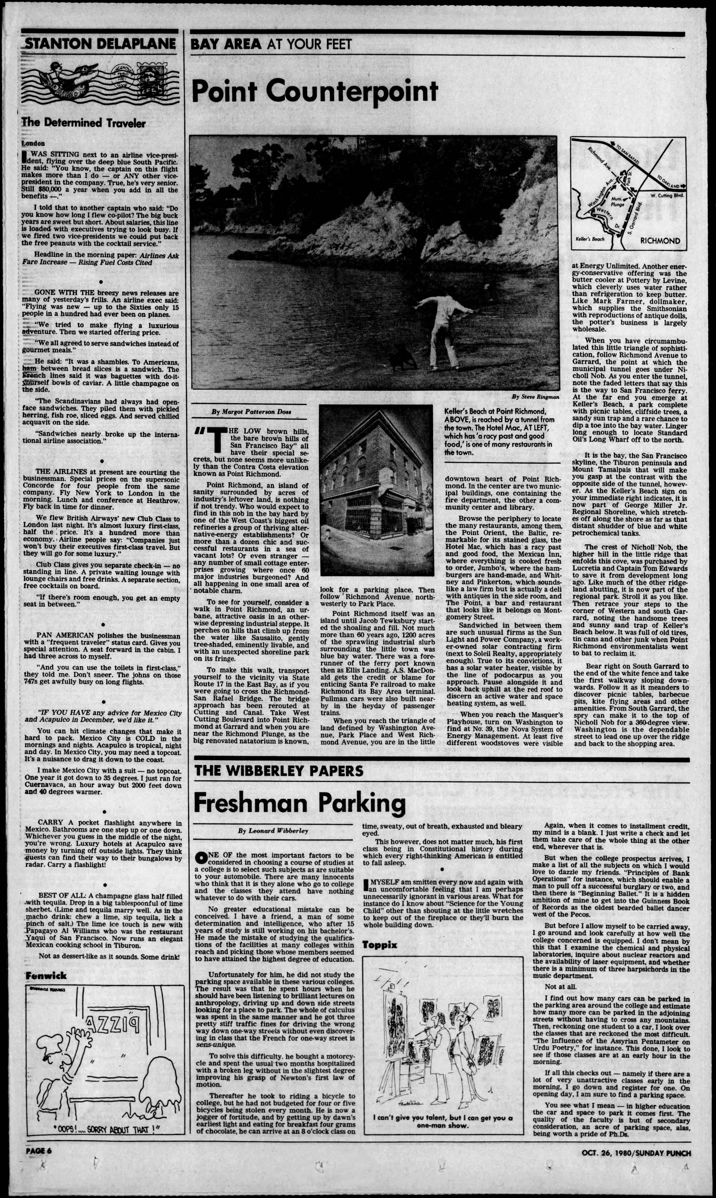
"Point Richmond, an island of sanity surrounded by acres of industry's leftover land, is nothing if not trendy. … more than a dozen chic and successful restaurants in a sea of vacant lots …" Margot Patterson Doss, "Point Counterpoint," San Francisco Sunday Examiner & Chronicle, "Sunday Punch," Oct. 26, 1980, p. 6
Doss's 1980 walking tour called the town "an urbane, attractive oasis in an otherwise depressing industrial steppe," with a downtown of "many restaurants" around "this little triangle of sophistication." Her advice to visitors arriving by car began, tellingly: when you are near the Plunge, "look for a parking place."
Paid for, built, kept up
- Paid for · 1981Owners of 60.25% of private property signed petitions to assess themselves.Source: Oakland Tribune, Nov. 16, 1981
- Built · 1983A paved, lighted lot for 84 vehicles, "virtually completed."Source: This Point…in Time I-5 · II-1
- Kept up · 1984Merchants sponsored cleanup crews, and the lot was "frequently totally filled."Source: This Point…in Time III-2
At a glance
- 1967Study: 126-space deficit
- 1979Business Association push begins
- c.1980Santa Fe threatens to fence off 84 spaces
- Nov 1981Owners' petitions; Tribune story
- Nov–Dec 1982Plans done, bids
- Jan 1983Final hearing
- 1983Lot built
- 1984"Frequently totally filled"
- 2008–19District still in City records
- 2026City concepts cut 0–56 spaces
Timeline
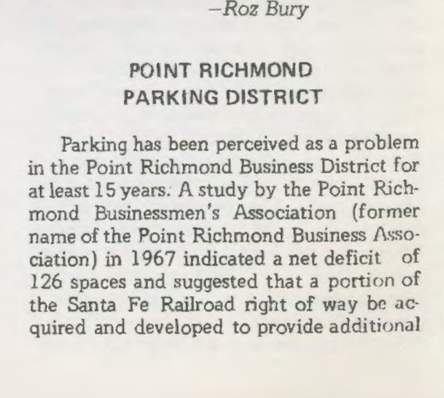
- 1967: A Point Richmond Businessmen's Association study finds a net deficit of 126 parking spaces and recommends acquiring part of the Santa Fe Railroad right-of-way for parking. The idea "died from lack of support."This Point…in Time, Point Richmond History Association newsletter, Vol. I No. 5 (Dec. 1982) and Vol. I No. 1 (May 1982)
- 1979: The Business Association "began once again, in 1979 to work for the creation of a Railroad Avenue parking area." That year a Santa Fe official, M.W. Lloyd, said he "could recommend" selling the 20-foot strip, with title going to "a governmental agency, preferably the city of Richmond under threat of condemnation." He later wrote the Richmond Redevelopment Agency that the railroad was willing to sell for $23,850.This Point…in Time, Vol. I No. 5 (Dec. 1982); Oakland Tribune, Nov. 16, 1981
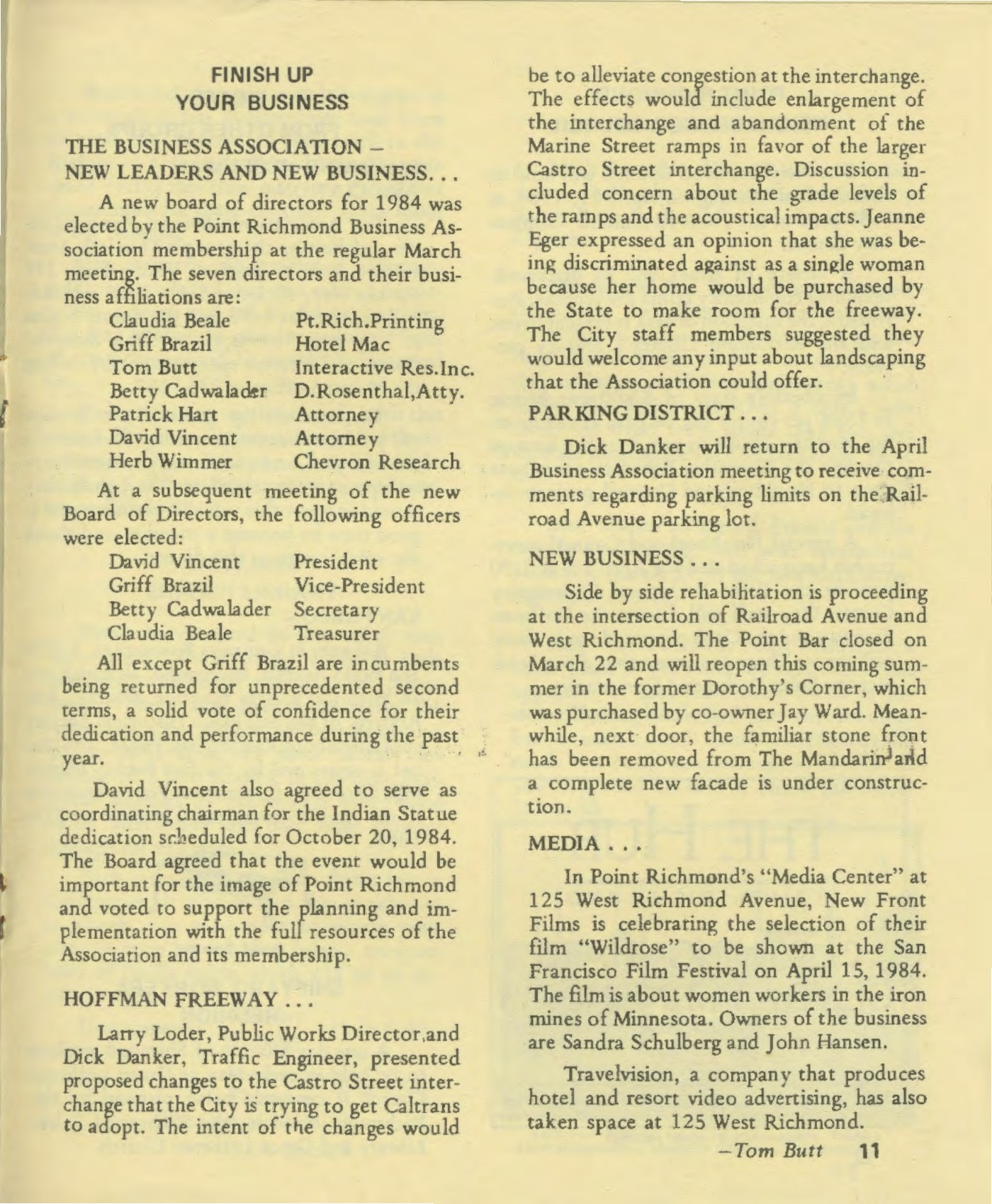
- c. 1980: Santa Fe "let it be known" it intended to fence off the right-of-way directly east of Railroad Avenue, which served as unofficial "overflow" parking "for many businesses, commuters and employees." Businesses were "in some real danger of actually losing about 84 parking spaces."This Point…in Time, Vol. I No. 5 (Dec. 1982), which says "about two years ago"
- Oct. 26, 1980: Margot Patterson Doss's Sunday Examiner & Chronicle walking tour describes "more than a dozen chic and successful restaurants" in the triangle and tells visitors to "look for a parking place.""Point Counterpoint," Sunday Punch, p. 6
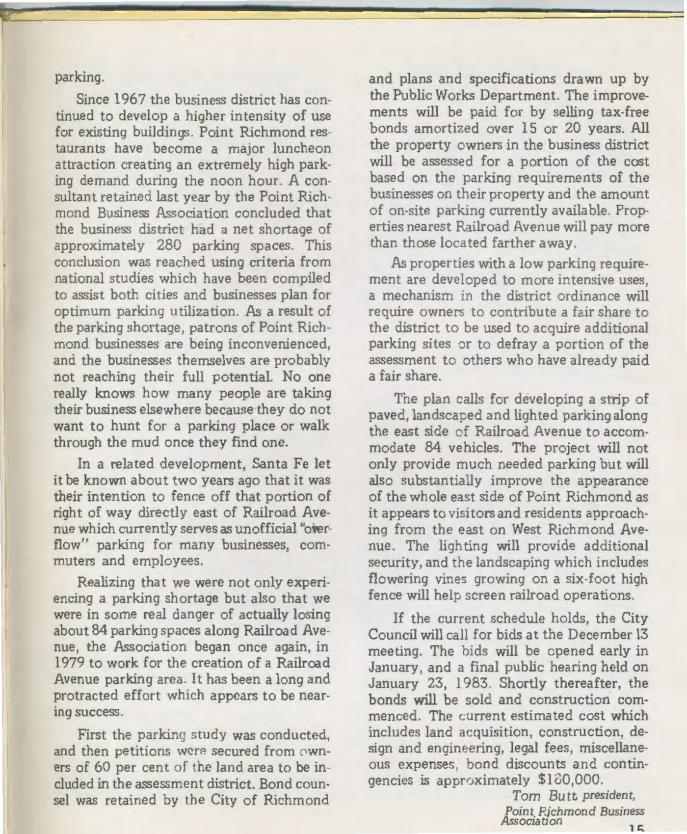
- c. 1981: A consultant hired by the Business Association finds a net shortage of about 280 spaces, using national parking-utilization criteria. "Point Richmond restaurants have become a major luncheon attraction creating an extremely high parking demand during the noon hour." Patrons "are being inconvenienced," and "no one really knows how many people are taking their business elsewhere because they do not want to hunt for a parking place or walk through the mud once they find one."This Point…in Time, Vol. I No. 5 (Dec. 1982), which says "last year"
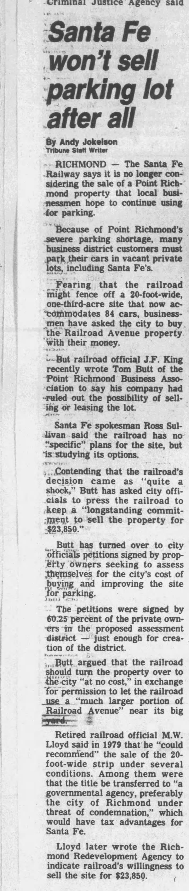
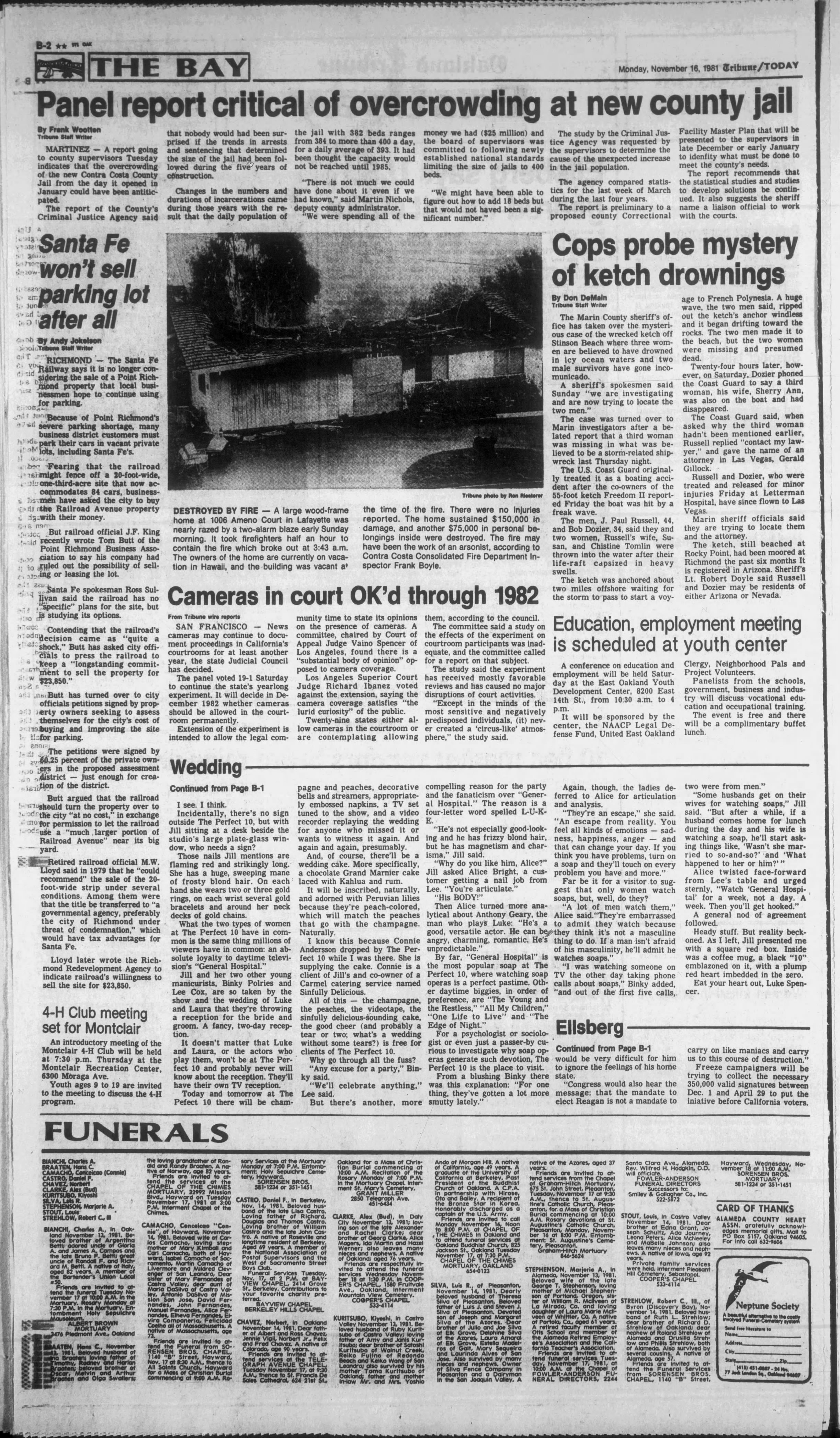
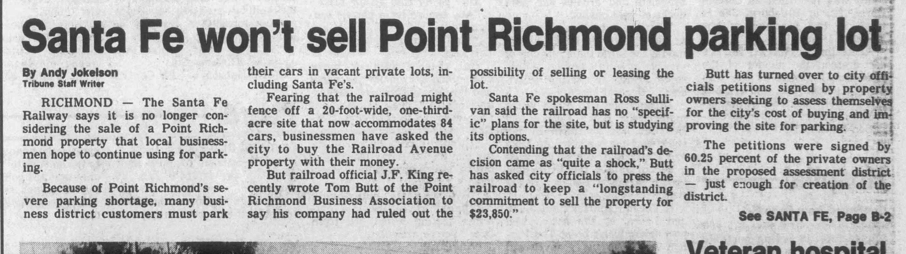
- Nov. 16, 1981: The Oakland Tribune reports that Santa Fe "is no longer considering the sale." Business Association president Tom Butt turns over petitions from property owners "seeking to assess themselves for the city's cost of buying and improving the site for parking," signed by 60.25 percent of private owners in the proposed district, "just enough for creation of the district." He calls the railroad's reversal "quite a shock."Andy Jokelson, "Santa Fe won't sell parking lot after all," Oakland Tribune, Nov. 16, 1981, p. B-2
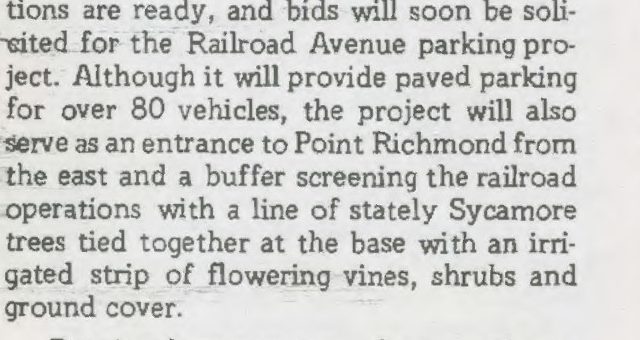
- Nov. 1982: "Plans and specifications are ready, and bids will soon be solicited for the Railroad Avenue parking project." Besides "paved parking for over 80 vehicles," it would "serve as an entrance to Point Richmond from the east and a buffer screening the railroad operations with a line of stately Sycamore trees tied together at the base with an irrigated strip of flowering vines, shrubs and ground cover."This Point…in Time, Vol. I No. 4 (Nov. 1982), p. 12
Vol. I No. 4 (Nov. 1982), p. 12. Credit: This Point…in Time, Point Richmond History Association. Tap to enlarge. - Dec. 1982: Petitions have been "secured from owners of 60 per cent of the land area to be included in the assessment district." The City has retained bond counsel, and Public Works has drawn plans for "a strip of paved, landscaped and lighted parking along the east side of Railroad Avenue to accommodate 84 vehicles," with "flowering vines growing on a six-foot high fence" to screen rail operations. Tax-free bonds would be "amortized over 15 or 20 years." Each owner's assessment would be based on "the parking requirements of the businesses on their property and the amount of on-site parking currently available," with properties nearest Railroad Avenue paying more and a mechanism so owners who later intensify their use "contribute a fair share." Estimated cost: about $180,000, including land acquisition, construction, design and engineering, legal fees, bond discounts and contingencies.Tom Butt, president, Point Richmond Business Association, "Point Richmond Parking District," This Point…in Time, Vol. I No. 5 (Dec. 1982), pp. 14–15
Vol. I No. 5 (Dec. 1982), p. 14 (article opens). Credit: This Point…in Time, Point Richmond History Association. Tap to enlarge. 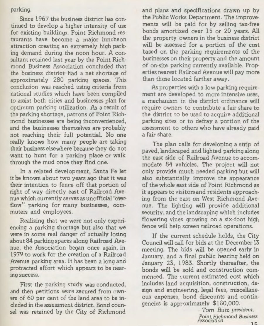
Vol. I No. 5 (Dec. 1982), p. 15. Credit: This Point…in Time, Point Richmond History Association. Tap to enlarge. - Jan. 23, 1983: Scheduled final public hearing. "Shortly thereafter, the bonds will be sold and construction commenced."This Point…in Time, Vol. I No. 5 (Dec. 1982)
- 1983: The Railroad Avenue parking project is "virtually completed."This Point…in Time, Vol. II No. 1 (mid-1983)
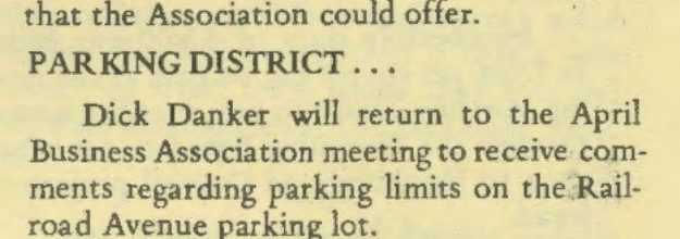
- Apr. 1984: City Traffic Engineer Dick Danker "will return to the April Business Association meeting to receive comments regarding parking limits on the Railroad Avenue parking lot."This Point…in Time, Vol. II No. 8 (Apr. 1984), p. 11
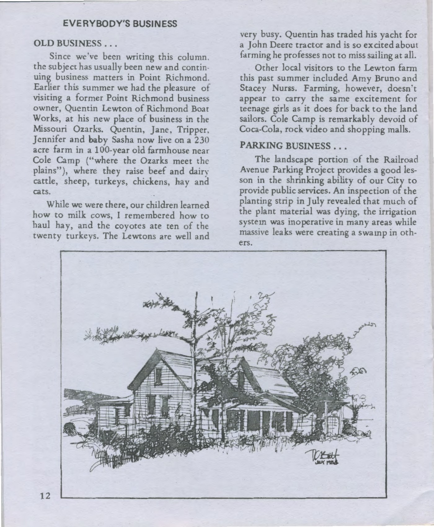
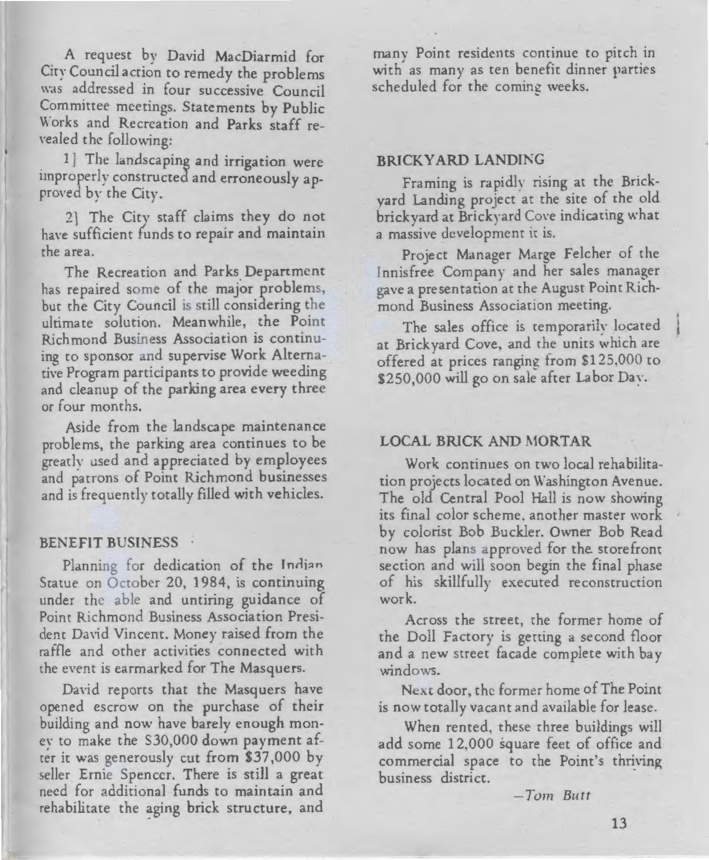
Vol. II No. 8 (Apr. 1984), p. 11. Credit: This Point…in Time, Point Richmond History Association. Tap to enlarge. - Sept. 1984: The lot "continues to be greatly used and appreciated by employees and patrons of Point Richmond businesses and is frequently totally filled with vehicles." The landscaping had problems: plants "dying," irrigation "inoperative in many areas," and City staff said the work was "improperly constructed and erroneously approved by the City" and that they lacked funds to maintain it. The merchants kept it up: the Business Association was "continuing to sponsor and supervise Work Alternative Program participants to provide weeding and cleanup of the parking area every three or four months.""Parking Business," This Point…in Time, Vol. III No. 2 (Sept. 1984), pp. 12–13
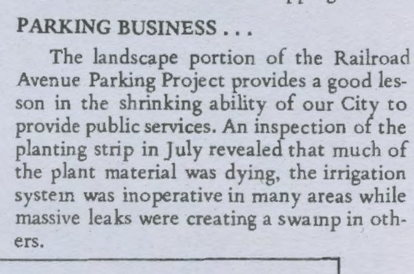
Vol. III No. 2 (Sept. 1984), p. 12 ("Parking Business"). Credit: This Point…in Time, Point Richmond History Association. Tap to enlarge. 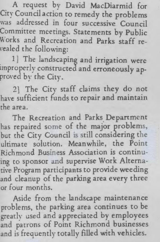
Vol. III No. 2 (Sept. 1984), p. 13. Credit: This Point…in Time, Point Richmond History Association. Tap to enlarge. - 2008–2019: City financial reports still list a "Point Richmond Parking" special assessment district. The City's fee schedule lists a "Point Richmond Parking District Fee" that "applies to the Point Richmond downtown commercial area."City of Richmond CAFR FY2007–08; Master Fee Schedule (eff. July 18, 2019), RMC 6.02.180
- 2026: The City's Connectivity Project concepts would remove 29 to 56 Railroad Avenue spaces (Ideas A–C), 4 (Idea D) or none (Idea E, the path on railroad land).CSWST2 draft memo, Sept. 22, 2026
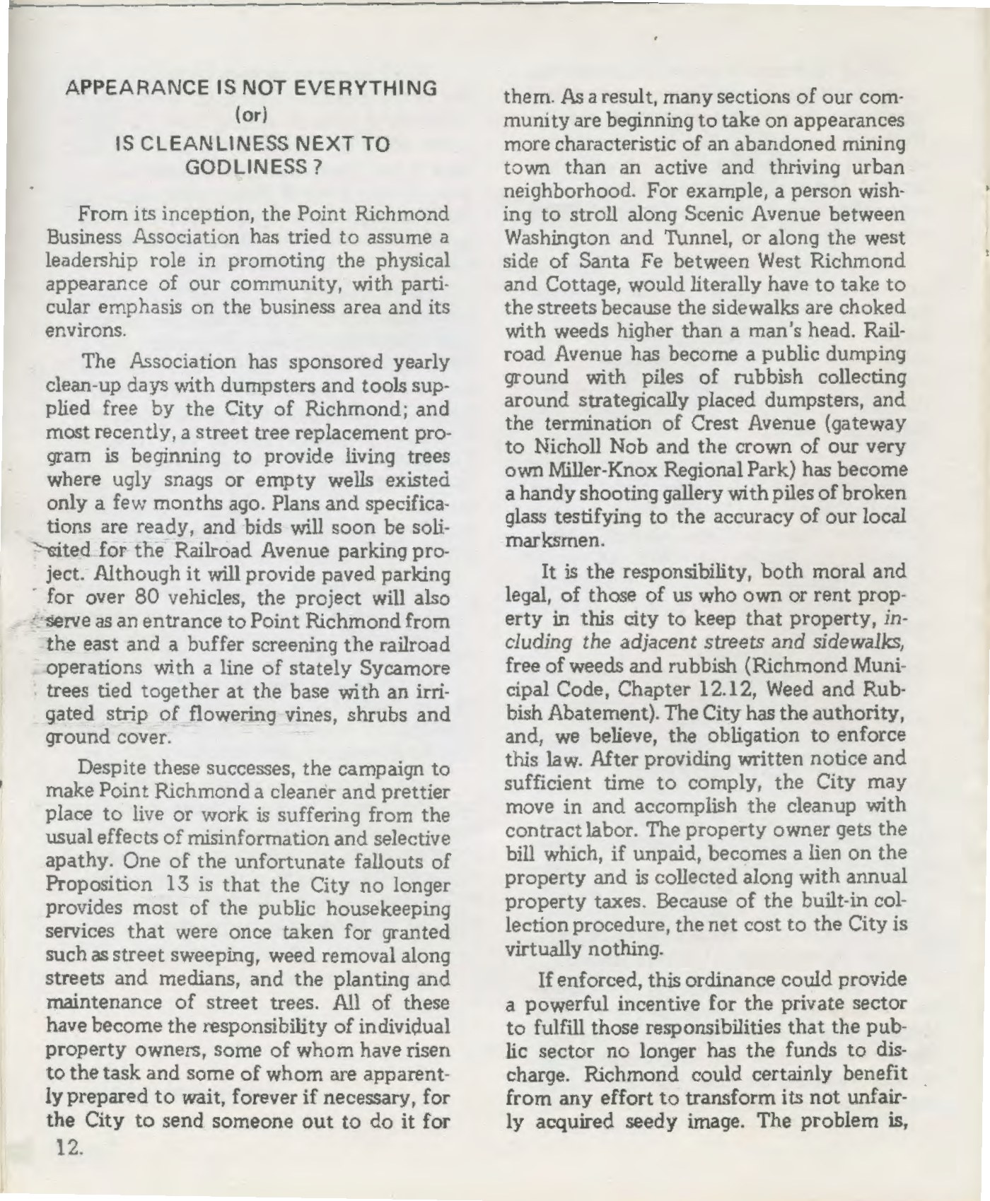
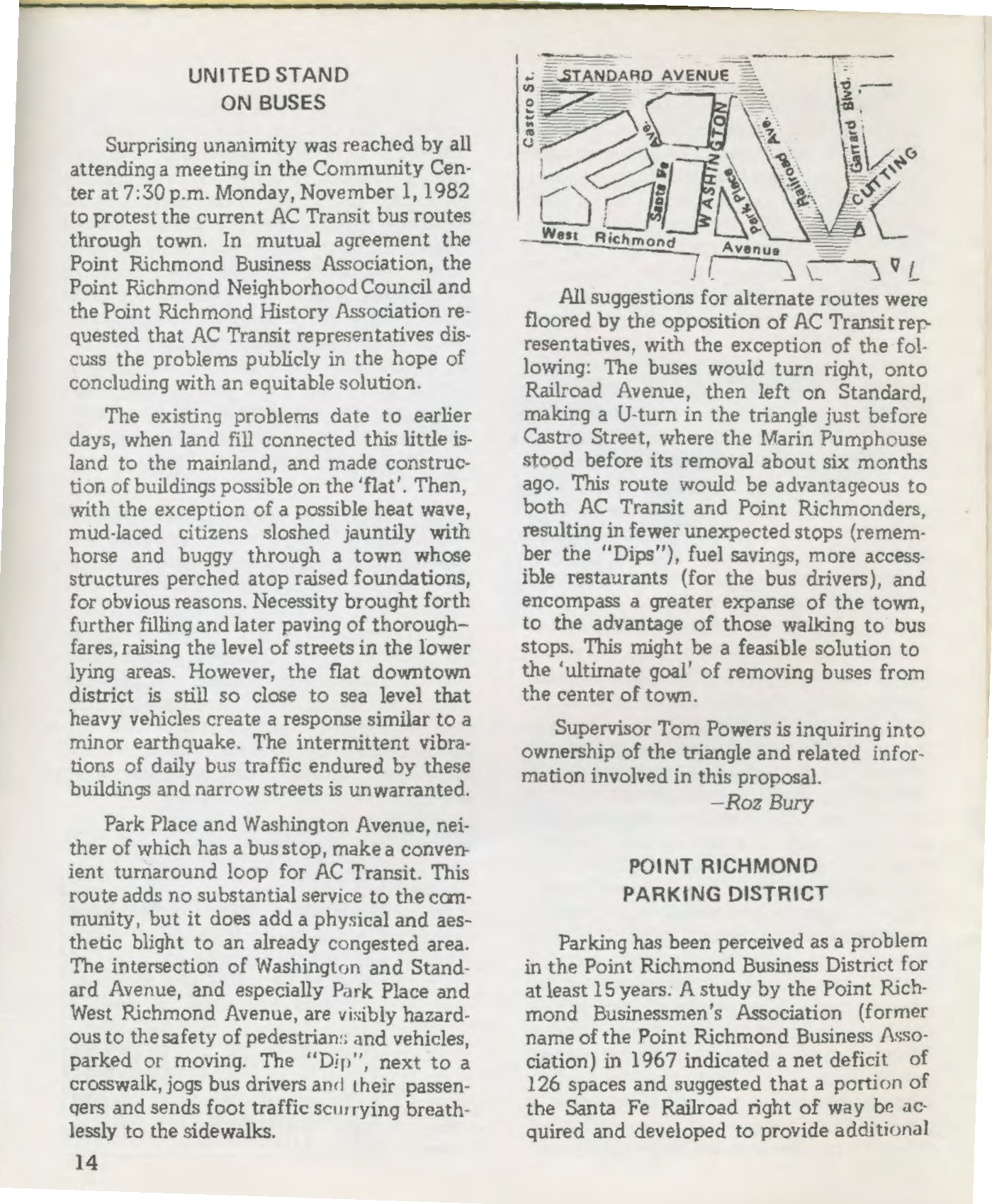
Then and now: the Railroad Avenue lot
From the archives
Newspaper clippings reproduced for historical reference.
The Connectivity Project today
The City's Downtown Point Richmond Bicycle and Pedestrian Connectivity Project aims to close a gap in the citywide bike network and the San Francisco Bay Trail through downtown Point Richmond. It covers Garrard Boulevard, Tewksbury Avenue, West Richmond Avenue and Railroad Avenue. The budget is about $1.9 million (about $1.4 million for construction), from a federal Housing Incentive Pool grant, a state TDA Article 3 grant, and local match administered by the West Contra Costa Transportation Commission.
- Schedule: concept design and outreach began March 2026. Design is to be complete by July 2027, with construction from March 2028 to spring 2029 (City staff report, Sept. 15, 2026).
- Outreach so far: Open House (May 23), Walk & Roll tour (May 30), survey #1 (282 responses), options workshop (Sept. 12), and survey #2, which closed Oct. 23, 2026.
- Next: the City will present a preferred design at Workshop #3 on Sat., Nov. 14, 2026, then take it to City Council for approval.
- Railroad: on Sept. 15, 2026, staff asked Council to approve a $50,000 engineering agreement with BNSF for the West Richmond Ave crossing. The City's project manager has said a BNSF easement for a trail is "unlikely to occur within the timeframe of the current project." The City already has an engineering relationship with BNSF; we ask it to use that to pursue the easement now.
The five Railroad Avenue concepts
| Concept | Spaces removed | Traffic | Bikes | Emergency access |
|---|---|---|---|---|
| A "Single Track" | 29 | One-way northbound | Protected SB track + NB lane | ~18 ft clear, below 20-ft minimum (Fire Dept. to decide) |
| B "Main Line" | 29 | One-way northbound | Two-way cycle track | Fails fire standards, "not feasible" |
| C "Double Track" | 56 | Two-way kept | Two-way cycle track | Likely meets standard (to confirm) |
| D "The Local" | 4 (29 if back-in parking added) | Two-way kept | Shared lanes ("sharrows") | Unchanged from today |
| E "The Spur" | 0 | Two-way kept | Separate path on BNSF land | Unchanged; needs BNSF easement (City calls it long-term) |
Tewksbury Avenue: the concept extends the two-way protected bikeway to Railroad Avenue and widens the sidewalk, but removes 9 of 13 on-street spaces. West Richmond Ave / South Garrard: the concept adds 8 spaces on South Garrard and keeps 21 on West Richmond.
The City says Ideas A to D can each be built within the construction budget. Idea E is "long term if BNSF agrees." Ideas D and E are the two that come closest to preserving parking, and E is the only one that keeps every space.
Safe bike infrastructure that brings riders to our businesses
We oppose any loss of parking spaces. We also support safe bike infrastructure and closing the Bay Trail gap, and the question is where riders go. A fast, separated lane designed to move riders past the district on Railroad Avenue costs the most parking, and it also routes riders away from the historic downtown business district and the businesses that would benefit from them.
- Riders who stop are good customers. In a Portland State University study of restaurants, bars and convenience stores, cyclists spent about the same per visit as drivers, but visited more often and spent more per month (Clifton et al., 2012). That only helps businesses if riders pass by the door and have a place to lock up.
- Slow is the point. Commenters at the City's outreach said cyclists should "go slow through Pt Richmond" and that "bikeways through town with speed humps and with other traffic calming would be a win-win for everyone" (TRAC stakeholder meeting, May 14, 2026). The City's Idea D, "The Local," keeps riders in shared, calmed lanes through the core.
- Put bike racks where cars can't park. Workshop participants suggested bike parking "in areas where vehicle parking is already prohibited, such as red-curb areas near coffee shops and restaurants," and asked the team to support "opportunities for bicyclists to stop and visit downtown businesses."
- Wayfinding into town. Signs and pavement markings can guide Bay Trail riders up West Richmond Avenue and around the triangle on Park Place and Washington Avenue, where the cafes are, before they continue to Tewksbury and the Bridge.
Honest limits: the Portland study measured per-visit and monthly spending, not total sales, and it was done in a large city. The City's consultants note that Idea D "does not close the gap in the San Francisco Bay Trail" to the preferred standard, and that shared lanes are less comfortable for riders of all ages. Back-in angled parking would improve safety but, in the City's count, raises Idea D's parking loss from 4 to 29.
Get involved
- Point Richmond Neighborhood Council general meeting. Guest: Interim City Manager Mark Scott. Details at pointrichmond.org.
- City Workshop #3: Preferred Design, Point Richmond Community Center, 139 Washington Ave. This is the key meeting before the design goes to City Council.
- Online survey #3 on the preferred design. The link will be posted on the City project page.
- City Council hearing to approve the design. Watch City Council agendas.
Who to contact
- Gail Payne, Senior Transportation Planner and project manager, City of Richmond Public Works: Gail_Payne@ci.richmond.ca.us · (510) 620-6716
- Richmond City Council: see the City website. Direct council contacts coming soon. · ci.richmond.ca.us
- Point Richmond Neighborhood Council: pointrichmond.org
- Sign up for City project updates on the project notifications page.
Five things you can do this week
- Put Nov. 14, 10 am on your calendar and bring a neighbor.
- Send a short, polite comment to the project manager asking that any design preserve parking (sample below).
- Business owners: put the QR code at your register. Print the one-page flyer.
- Fill out survey #3 when it opens on Nov. 14.
- Share old photos or documents about the 1980s parking district.
Sample comment letter (edit to make it your own)
Stay in touch
Email sign-up: coming soon. In the meantime, sign up for the City's own project updates on the project notifications page, and come to Workshop #3 on Nov. 14.
Organizer and contact information coming soon.
Share this page
These are plain links. Nothing is loaded from Facebook, Nextdoor or anyone else until you click one.

Print the QR code for counters and windows, or print the one-page flyer. Both open savepointparking.org.
Sources
Historic
- Andy Jokelson, "Santa Fe won't sell parking lot after all," Oakland Tribune (Tribune/Today, "The Bay"), Mon., Nov. 16, 1981, p. B-2. Page scan · Article · Clipping
- Margot Patterson Doss, "Point Counterpoint" (Bay Area at Your Feet), San Francisco Sunday Examiner & Chronicle, "Sunday Punch," Oct. 26, 1980, p. 6. Page scan
- Tom Butt, "Point Richmond Parking District," This Point…in Time (Point Richmond History Association newsletter; early issues titled This Point), Vol. I No. 5, Dec. 1982, pp. 14–15. PDF
- This Point…in Time (PRHA), Vol. I No. 1, May 1982 (1967 parking study). PDF
- This Point…in Time (PRHA), Vol. I No. 4, Nov. 1982, p. 12 (bids soon; "over 80 vehicles"; eastern entrance with Sycamores and flowering vines). PDF
- This Point…in Time (PRHA), Vol. II No. 1, mid-1983 (project "virtually completed"). PDF
- This Point…in Time (PRHA), Vol. II No. 8, Apr. 1984, p. 11 ("Parking District": parking limits on the Railroad Avenue lot). PDF
- This Point…in Time (PRHA), Vol. III No. 2, Sept. 1984, pp. 12–13 ("Parking Business": heavy use, landscape problems, Business Association upkeep). PDF
- Point Richmond History Association newsletter archive. pointrichmondhistory.org
- City of Richmond Planning Commission minutes, Nov. 4, 2010 (PLN 10-123; describes parking assessment district). PDF
- City of Richmond Comprehensive Annual Financial Report, FY ended June 30, 2008 (lists "Point Richmond Parking" special assessment district). PDF
- City of Richmond Master Fee Schedule, eff. July 18, 2019 ("Point Richmond Parking District Fee"). PDF
Connectivity Project (City of Richmond)
- Project website: Home · Get Involved
- CSWST2, Draft Memorandum, "Concept Ideas," Sept. 22, 2026. PDF
- Workshop #2 (Sept. 12, 2026) comment-card summary. PDF · Presentation boards: PDF · Slides: PDF
- Online Survey #1 summary (282 records; Apr. 27 to June 4, 2026). PDF · Open House summary: PDF · Walking tour summary: PDF
- City Council staff report, "Preliminary Engineering Services Agreement with BNSF…," Sept. 15, 2026. PDF
- Project email update (CSWST2/MailerLite), Oct. 2026: survey extended to Oct. 23, and Workshop #3 on Nov. 14, 10 am to noon, at 139 Washington Ave.
Research on bikes and business
- Volker, J. & Handy, S. (2021). "Economic impacts on local businesses of investments in bicycle and pedestrian infrastructure: a review of the evidence." Transport Reviews 41(4). doi
- Clifton, K. et al. (2012). Consumer Behavior and Travel Mode Choices. Portland State University / OTREC. PDF
- Arancibia, D. et al. (2019). "Measuring the local economic impacts of replacing on-street parking with bike lanes: A Toronto (Canada) case study." J. American Planning Assn. 85(4). doi
- McCoy, R., Poirier, J. & Chapple, K. (2019). "Bikes or Bust? Analyzing the Impact of Bicycle Infrastructure on Business Performance in San Francisco." Transportation Research Record 2673(12). doi